
A view looking down the trail, east toward the plains.

Virgin trail that will link up Blue Sky to Coyote Ridge and extend south to Devil's Backbone.

Far off, is Devils Backbone, middle of the picture:

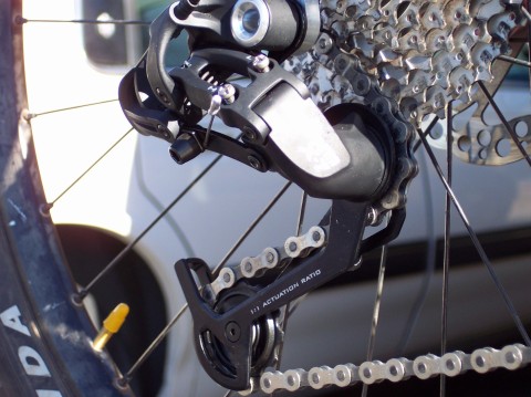
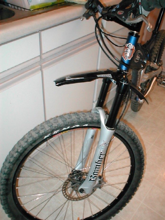
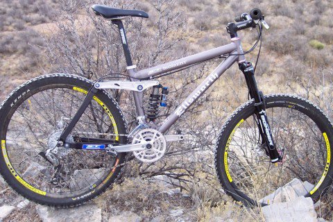
I went with the X.7 instead of the X.9 that I broke. It was cheaper and only marginally heavier (40g). The action seems to be the same. So far, so good!
The first ride was at Coyote Ridge. Coyote Ridge is kind of the sister trail to Devil's Backbone, though they are different in character, they share many attributes and are only about 7 miles apart, driving. Off road, they're closer. Trails to connect these two locations are in the works.
It's a mile of climbing from the car. This pic is about 1/2 way through to the top, looking up, then back. A bit of snow still lingered on the north side climbing up. It always does on this trail.

A view east of the Great Plains. This is the first ridge of the Foothills of CO. Beyond this stuff, it's all higher and higher altitude. Coyote Ridge peaks out at about 5,700', starting at about 5,100'.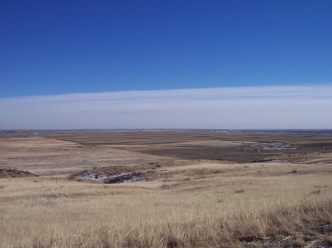
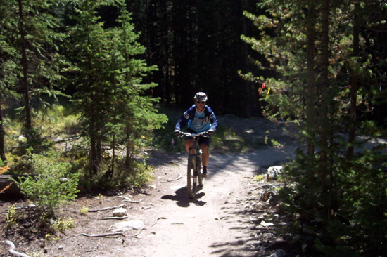
I figured out the timer on my camera and got this shot. I didn't go for anything artistic, but it turned out pretty good!
The most exciting part of this ride was seeing some of the new Indian Creek trail that's been constructed. I worked on this trail last Fall, helping to build a culvert through a small valley (before and after):

That metal pipe is now buried under rocks and dirt. It took a day to build this and another half day to fill in the gaps and pack it down. There were over 250 volunteers building 2 miles of trail in 2 days. In the next photo, you can see where we were working by following the trail to the first small canyon, just where the shadows obscure the trail. Rest assured that this culvert is now there and that the trail flows through that spot!
This part of the trail will link Indian Creek/Blue Sky trail with Coyote Ridge. I tired to follow the line and see where, but it's not evident yet. Apparently the county wants to wait until the last minute to connect them up so that users will stay off until it's officially opened in Spring/Summer 2006. The trail will go from Devils Backbone Open Space to Horsetooth Mountain Park in Fort Collins. It's estimated to be 20+ miles one way. Further trails can be found at Horsetooth and adjoining Lory State Park, making for some epic rides. Horsetooth Rock, roughly 10 miles away at 7,300' elevation.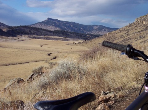
On a subsequent ride the following day, I spoke to a Larimer County Park Ranger and she noted that work to Horsetooth was progressing quickly. They plan to have the trails open by June 2006.


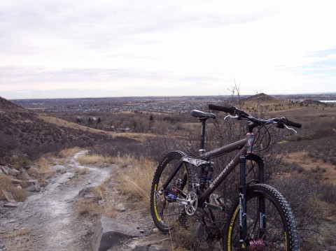


The sky was blue and the sun was shining. It was going to be a good ride.
So, I climbed over the first hogback and on to the trail head. The fork wasn't right, so I added some psi. Up to 20psi. I guess the fork is supposed to be this mushy, but I don't like it. I tried it anyway and it was going fine. I was ripping along, hit my favorite jump - huge, then flatted on the subsequent climb out. Crap! Maybe the rear is too soft now? Adjusted that, grabbed a photo of the Backbone.
I've been struggling to climb this bike because of it's added weight (and mine!). But I made it up and grabbed a few more photos. Boy was it sunny!

The last time I stopped here to take pics, I was fixing another flat. It's time to go Tubeless. How do I explain that to my wife? Must...have...more...money...
Moving right along, I got some shots of the trail, just to profile how rocky it actually is out there. The new bike rolls over this stuff pretty easily. But so far, to me, it seems the same as the old bike. Could this be? Maybe it's me...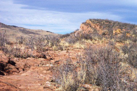

So, I've had some pretty good wrecks on this trail and drawn lots of blood. But this day, I think I'd rather have hurt myself. Well, maybe not, but anyway...
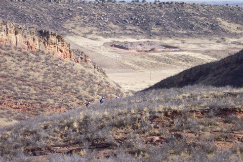
So, it was crowded on the trail, even on the backside where hikers and horses normally don't go. My goal was to head down the slope and catch these guys on the backside of the trail (okay, there's a pic, but it's not loading). At this point, they were walking. I knew I wouldn't have to walk that section, so I had a chance. Little did I know, I'd never make it...
Well, to make a long story short, I went over the bars as my front tire wedged in front of a rock and (unbeknowst to me at the time) slammed the rear derailleur down on one of those nasty rocks. After about 30 minutes of converting the bike to a singlespeed, I was able to limp out. The front tire suffered some punture, too, so I aired it up and went slow down the hill. 2nd flat of the day. Crap!
The aftermath. It's gonna be 'spensive!


